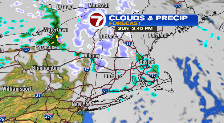

Happy Sunday morning! While we’ll be bright early this morning, clouds will roll in later this morning and this afternoon those clouds could produce some spotty light rain or snow. It’s a cold start out there in the 20s and 30s, with afternoon highs into the low 40s. The spotty rain and snow is possible after about 2 p. m. this afternoon and well into the evening hours. But, we aren’t expecting any accumulation where the snow showers will fall. Overnight, we’ll get down to the upper 20s and low 30s. Monday afternoon we’ll top off in the upper 40s with partly sunny skies and breezy conditions. Our next chance for rain comes Tuesday evening and overnight into Wednesday. That’s when it’ll be most widespread. Tuesday morning we’ll be down to the upper 20s with highs into the low 50s. Wednesday, the rain dwindles to just isolated shower chances and it’ll be warm! Expect highs into the upper 50s. Thanksgiving Day, there’s a low-end chance for a spot shower or flurry but that’s about it! Most of the day looks dry and partly sunny. It’ll be breezy and in the upper 40s in the afternoon after a morning in the low 40s. Overall, not a bad day! Whether you’re driving home Friday or doing some shopping, the forecast looks great again. Saturday will be dry again for more post-Thanksgiving travel. Stay tuned!.
https://whdh.com/weather-blog/spotty-rain-snow-sunday-before-drier-monday/